Approaching philanthropy with entrepreneurial thinking: the story of founding Virgin Unite 20 years ago
18 March 2024


Did you know that many parts of the world remain unmapped? This means that when disaster strikes, the response and recovery efforts become increasingly difficult. Open Mapping is vital in addressing disaster and climate resilience; public health; displacement and migration; gender equality; and the creation of sustainable cities and communities. This is where the Humanitarian OpenStreetMap Team (HOT) comes in. When a major disaster strikes anywhere in the world, it is incredible to see thousands of HOT volunteers come together online and, at times, on the ground to help first responders reach those in need. Through remarkable tech projects and impeccable coordination, HOT is saving and improving lives in some of the most vulnerable places in the world. This is why we are so proud to support HOT through Virgin Unite.
Open mapping is a field that is unknown to many of us, so I wanted to try and understand more by talking directly to the incredible people who are saying lives every day utilizing amazing technologies. I hope you find our interview as insightful and as uplifting as I did.
What is your mission at HOT? What gets you out of bed in the morning?
Rebecca Firth, Executive Director: Our mission at HOT is deeply rooted in leveraging open mapping technologies to support disaster response, humanitarian aid, and community development efforts worldwide. We believe that missing data should not be a reason for human suffering or loss of life. Our communities are driven by the power of open data, easily accessible and usable tools, and collaborative mapping to save lives, build resilience and empower communities. Our goal is to map one billion people living in 94 countries, so they will have the data, skills, and tools needed to be prepared for crises. We work closely with communities, NGOs, international organisations, and government partners to use open maps to address local challenges. These communities have a deep understanding of local problems and lead the work. Our tools are free for all and leveraged by partners such as Red Cross societies, Médecins Sans Frontières, UN agencies and programs, government agencies, and local NGOs and communities.
What motivates us is the impact from the incredible work that our mapping communities are doing, bringing us closer to our goal of creating a more equitable and resilient world. Our efforts have improved access to critical resources, enhanced disaster preparedness, and addressed local issues on multiple fronts from climate to gender to public health and many other critical issues.
Tatiana, can you share your experience as a mapper? What does it involve and what does it mean to you?
[Tatiana Pará Monteiro de Freitas is a professor specialising in geotechnologies, founder of the group "Meninas da Geo" (Girls of Geo), and a mother of two from the Brazilian Amazon. Tatiana was also a mentor for the first YouthMappers chapter in the Brazilian Amazon, and was named one of the Geospatial World 50 Rising Stars in 2023.
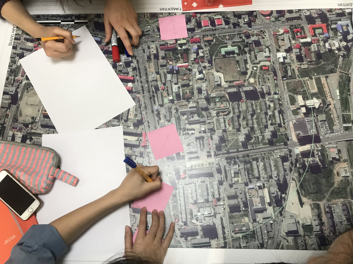
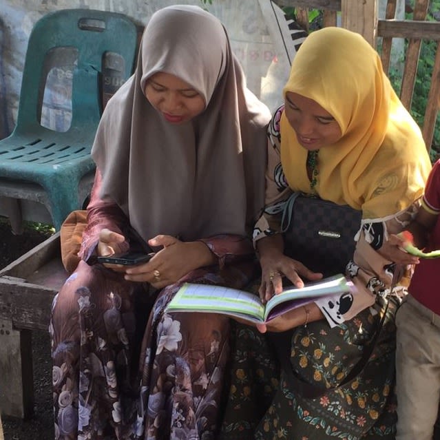
Through collaborative mapping, I can better understand my region. I travel along the rivers of the Amazon, using online and offline applications such as OSMAnd and OpenStreetMap, that has helped me cover about 4,000 km with a GPS in hand to collect local data and input it into the OSM platform to make Amazonian communities visible. My greatest experience was working with the women's community on Pilatos Island in the municipality of Ananindeua, where we achieved public policy actions through collaborative mapping. This locality also presented one of the greatest challenges of my teaching career: teaching two illiterate people to map and using symbology to enable them to use geotechnological tools for self-mapping.
Mapping shows that we are alive. Mapping is work, profession, hobby, and necessity. Mapping is about having power and empowering others. The act of mapping is feeling free and present in the territory. It is resistance against the invisibility that the system imposes on minorities, and that's why collaborative, participatory, and social mapping makes so much sense for my life purpose.
How will AI change the open mapping field?
Leen D'hondt, Director of Tech & Data: The creation and updating of map data through AI is the most obvious game changer in open mapping. This means extracting real world objects from sensor data such as satellite imagery, drone imagery, and aerial imagery.
Using AI to improve the way sensor data (from sources like GPS devices) is processed and analysed will also radically change the open mapping field. AI for mapping has the potential to exponentially accelerate mapping speed and capacity, and HOT is actively investing in this. Today, for example, mappers can map between 1,000-1,500 buildings per day without AI. During an AI-assisted mapping pilot at HOT in 2020, technology allowed us to extract 18 million building footprints from satellite imagery, and mapping capacity nearly doubled to 2,500-3,000 buildings per person per day.
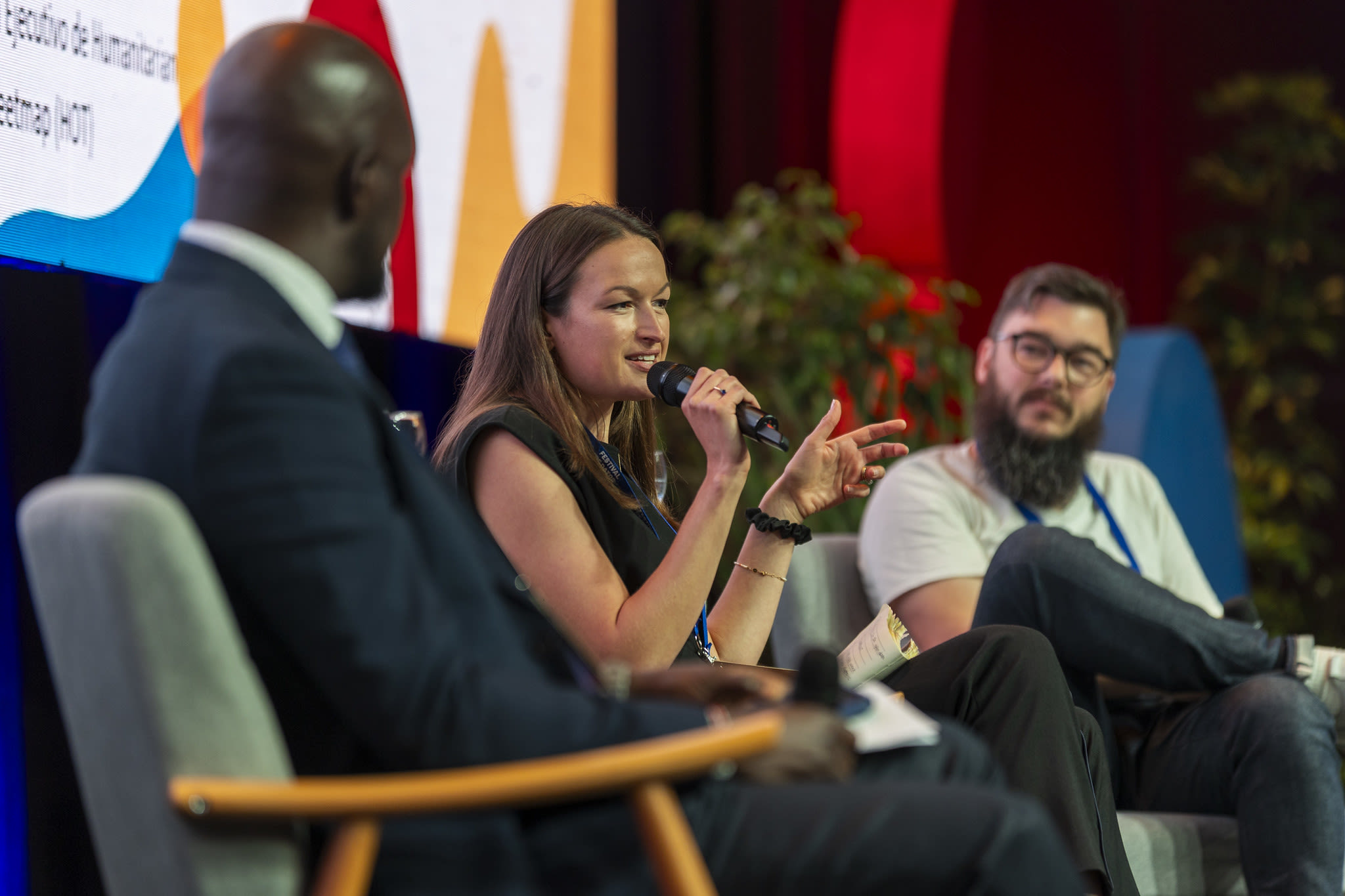
Can you tell us more about your work in the wake of the earthquakes in Syria and Turkey?
Can Unen, Senior Manager, Community and Partnerships - Asia Pacific: The Turkey-Syria earthquake saw our HOT community in Turkey (coordinated through HOT's local partner organisation, Yer Çizenler) lead the action. Recognising the need for global coordination, HOT orchestrated volunteer communities and partner organisations on an international scale. A diverse range of communities and organisations contributed to a shared dataset, working towards a collaborative environment to minimize inefficiencies caused by multiple actors trying to create similar datasets.
One notable challenge during the crisis was connectivity issues preventing first responders and search-and-rescue teams from accessing critical information via mainstream mobile mapping apps. This is where Organic Maps and the OpenStreetMap data acted as life savers enabling Dr. Çevik (Ankara surgeon) and his colleagues reach affected communities in the Hatay region.
The open mapping approach supported the rapid mapping of temporary infrastructure and enabled data-driven public health programming in displacement tent cities. To tackle these challenges with map data, more than 9,000 volunteers mapped over 2.2 million buildings and 80,000 kilometres of roads within the affected regions. This became a massively significant contribution reflecting the resilience and dedication of the mapping communities.
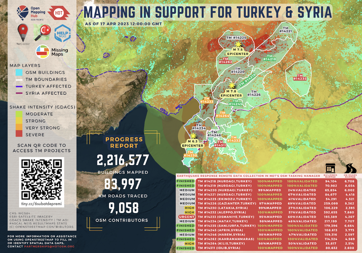
In the case of Syria, the challenges extended beyond connectivity issues. Because of the physical and political circumstances in the country, it was not possible to reach out to an organised OSM community to coordinate the mapping. Moreover, the open satellite imagery services accessed for mapping in OSM were more detailed and more up-to-date for Türkiye compared to Syria. Türkiye, being part of extended EU, was also able to get coverage within Copernicus, European Commission’s emergency management service, so Syria was in a less favourable situation in terms of knowledge and data resources to support and inform the mapping activities.
As a result of these collaborative mapping efforts, the damaged building datasets from these activations became the most downloaded dataset on the Humanitarian Data Exchange in 2023, demonstrating the success of a collaborative, data sharing, and community-driven mapping approach.
What’s next for HOT? Rebecca Firth, Executive Director
Moving forward, we are committed to expanding our reach and impact by further integrating innovative technologies, strengthening partnerships, and engaging with communities worldwide. Here are some of our key areas of interest:
HOT is working on the concept of fAIr: an intuitive, fair, and open-source AI-assisted mapping tool where AI models are created and trained by the people living and working in the local communities.
The Field Mapping Tasking Manager (FMTM) allows teams to add local knowledge to maps by coordinating features being mapped in the field. Through FMTM, mapping coordinators create mapping campaigns that assign individual areas and/or features to different field mappers, keep track of their contributions, manage the resulting data, and avoid duplication with other data collectors.
Climate change is disrupting communities across the world. At HOT we are partnering with them to identify their vulnerabilities and co-develop strategies to adapt to potential impacts. We do this through participatory mapping, capacity-building programs, fund distribution, accessible technology, adding high quality local data to the climate conversation, and creating broader networks of local partners.
Over the years, we have actively partnered with and supported other organisations by fostering collaborative efforts and providing resources, expertise, and training in open mapping techniques. Through strategic partnerships and community engagement, we hope to create a global open-mapping movement towards creating a more resilient and equitable world through open mapping and humanitarian action.